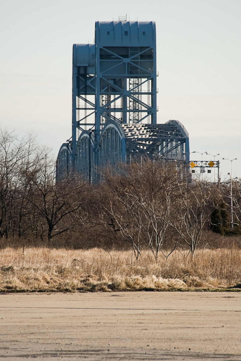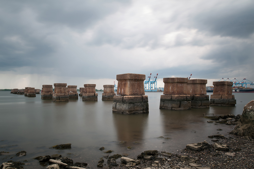
Central Railroad of New Jersey Newark Bay Bridge

Newark Bay Bridge piers
Central Railroad of New Jersey Newark Bay Bridge piers, 2015

Crossed: Newark Bay
Connected: Elizabeth and Bayonne, NJ [satellite map]
Carried: 4 railroad tracks (Central Railroad of New Jersey)
Design: Vertical lift bridge
Date opened: November 27, 1926
Date demolished: 1980-1988

The Central Railroad of New Jersey Newark Bay Bridge was a two-mile-long vertical lift bridge which consisted of two spans that each carried two railroad tracks. The bridge crossed two shipping channels in Newark Bay and therefore had two lift spans, each with two draws that could be moved independently. The bridge carried both passenger and freight trains.

Previous Bridges

The Central Railroad of New Jersey, also known as the Jersey Central (and often shortened to CNJ), was a railroad that had its beginnings in the 1830s. Originally called the Elizabethtown and Somerville Railroad, it connected Elizabethport and Elizabeth, NJ in 1831 before extending outward to Somerville in 1842. It was renamed the Central Railroad Company of New Jersey in 1849, as it continued its expansion by building new track and acquiring other railroads; by 1852 it reached Phillipsburg, on the Delaware River. The first bridge built by the CNJ across Newark Bay was a wooden trestle with a steel swing span that opened on a central pier. It carried two tracks and opened in 1864; this line ended at the Central Railroad of New Jersey Terminal, located on the Hudson River waterfront in what is now Liberty State Park in Jersey City (the original 1864 building was replaced in 1889 with the Romanesque structure which still stands).

A double Scherzer Rolling Lift bridge replaced a swing bridge in 1904. (Source: Engineering-News Record, Vol. 49, No. 9)
A double Scherzer Rolling Lift bridge replaced the 1864 swing bridge in 1904. (Source: Engineering-News Record, Vol. 49, No. 9)

In 1903, work was begun on a replacement for the wooden bridge. Maritime traffic had increased steadily, and the volume and size of the trains crossing the bridge had also grown. The swing span had to open frequently and the CNJ also wanted to plan for an expansion of the crossing from two tracks to four. The design selected consisted of two Scherzer Rolling Lift spans; a key advantage over the swing bridge was that the bridge would not need to open fully to allow passage of barges and other low ships. The two-track sections could be expanded to four by building an additional span with identical Scherzer Rolling Lifts next to the existing spans. The west leaf of the movable span was floated into place on February 14, 1904 [1] and followed by the east leaf a few months later. The new span was seen as a vast improvement over the wooden trestle.

From Newark Meadows to Port Newark

However, the character of Newark Bay continued to change. The city of Newark began dredging the shallow Newark Meadows during the 1910s to create an additional shipping channel, which later became Port Newark (it is now known as the Port Newark-Elizabeth Marine Terminal). During World War I the U.S. government used Port Newark to station troops. The Port Authority of New York and New Jersey was formed in 1921 and was followed by the Rivers and Harbors Acts of 1922, which authorized the creation of even more shipping channels. As the crossing closest to the new facilities and the longest crossing, the bridge came to be seen as a huge obstruction to the growing port [2]. Authorities in Newark were in favor of demolishing the bridge altogether and replacing it with a tunnel (which wouldn’t obstruct marine traffic at all). Cost was an issue; a tunnel was estimated at $100 million whereas a replacement bridge would cost $9 million. Proposed by the CNJ in 1922, the replacement bridge, of a vertical lift design, would have two spans (200 feet and 125 feet wide) that would raise for a maximum clearance of 135 feet above the water; they would replace the Scherzer spans which were 85 feet wide each. U.S. Secretary of War John W. Weeks decided in favor of a vertical lift bridge in December of 1922 [3]. However, that was not the end of opposition to the bridge. In November, 1924 a case was brought to the Supreme Court against the CNJ by the state of New Jersey (led by Newark and Jersey City), questioning the right of a railroad to build across a state’s navigable waters [4]. On March 2, 1925 the Supreme Court decided in favor of the railroad [5] and plans to replace the bridge moved forward.

Vertical Lift Bridge
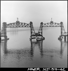
Vertical lift draws in the open position, looking north (Source: Historic American Engineering Record, NJ-37-42)

The Central Railroad of New Jersey sped construction of the new bridge as soon as approval had been granted. The bridge’s designer was John Alexander Low Waddell, a civil engineer well known for his vertical lift bridges. Waddell had moved to New York City in 1920 and was towards the end of a bridge-building career that had begun with a lift bridge in Chicago in 1892-3. The bridge was “believed to be the world’s longest drawbridge” [6]; the bridge’s Chief Engineer Arthur E. Owen declared it to be “the largest drawbridge assembly in the world” [7]. While neither claim was ever definitively proven, it would be hard to argue that the bridge was not impressive. The new spans carried four tracks over Newark Bay; the two shipping channels were crossed by double vertical lift spans that each operated separately from one another. The main difference in the functionality of the new bridge was that its height in the closed position was a minimum of 35 feet above the water, so while the Scherzer Rolling Lift improved upon the previous swing in that it only had to open partially for barges, the new bridge spans only had to open at all for taller ships (allowing the passage of many vessels at all times).

The new Central Railroad of New Jersey Newark Bay Bridge was formally opened on November 27, 1926. It had cost roughly $14 million (far higher than the original $9 million estimate several years earlier). The inaugural train riders included twenty-two “veteran” commuters of the line, most notably a resident of Elizabeth named K.S. Kiggins, who had also attended the first bridge opening in 1864 [8]. New Jersey governor Harry A. Moore, several New Jersey mayors, CNJ president Roy B. White, and many holding high positions at various other railroads were also in attendance. In 1927, W.C. Hope, the passenger traffic manager of the CNJ, released statistics stating the the new bridge had allowed 60% of all marine traffic to pass below it without opening, a steep decline in openings compared to the older bridge [9].

Tragedy

At 10am on September 15, 1958, a CNJ commuter train heading towards Bayonne from Bay Head plunged off the south span, which was partially lifted, and into Newark Bay. The train had proceeded past three stop signals; evidence of mechanical failure was never found and it was believed that the engineer had suffered a heart attack. After a dramatic rescue and recovery effort over the next several days, it was declared that 48 people had died in the tragedy–45 passengers and three crew members. Notable among the dead were former second baseman for the Yankees George (Snuffy) Stirnweiss and John Hawkins, the mayor of Shrewsbury, NJ. Later in 1958, the CNJ announced it would be adding new safety measures: automatic trippers would bring rogue trains to a stop if they ignored stop signals (by using a derail system), and “dead-man” controls would stop trains if the operator released the throttle [10].

Abandonment and Demolition
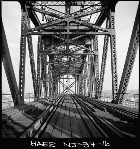
Deck of vertical lift span (Source: Historic American Engineering Record, NJ-37-16)

The bridge was in for more trouble, however. On a very foggy May 19, 1966, the French freighter S.S. Washington hit the northeast vertical lift span, rendering the two tracks it carried unusable. Furthermore, he overall decline of the railroads was taking its toll on the CNJ; overall ridership was down and in May 1967 the Aldene Plan went into effect. It rerouted CNJ trains departing from Aldene (in Roselle Park, NJ) to Newark rather than over the Newark Bay Bridge. This meant that the only passenger service over the bridge was a shuttle running from Bayonne to Cranford; nicknamed the “Scoot,” its service was very limited. In light of these changes, the damaged span was never repaired.

Use of the bridge continued its steady decline. By the 1970s, CNJ had moved the rest of their freight operation to Elizabeth and only two freight trains a day crossed the span.The Consolidated Rail Corporation (Conrail) took over the operations of the Central Railroad of New Jersey on April 1, 1976 and moved all freight operations to the Pennsylvania Railroad Newark Bay Bridge, north of the CNJ span. The last passenger train crossed the bridge was on August 6, 1978.

The abandoned bridge was deemed a hazard to navigation and an attempt was made to save the bridge by the City of Bayonne. The city was unsuccessful, and on July 11, 1980 explosives were used to partially demolish the bridge. The vertical lift spans and towers fell, engulfed in smoke. The approaches and remaining trestles were removed in 1987-1988, leaving only portions of the piers along the shorelines as visual reminders of the structure that once crossed the bay. The Bayonne Historical Society held a memorial for victims of the commuter train crash in 2008, 50 years after the accident, but other than that the bridge has been largely forgotten. Some remaining portions of the bridge were blasted away as recently as February, 2012 [11]. On the Bayonne waterfront, cormorants and seagulls can be seen roosting on the few crumbling piers that still extend into Newark Bay today.
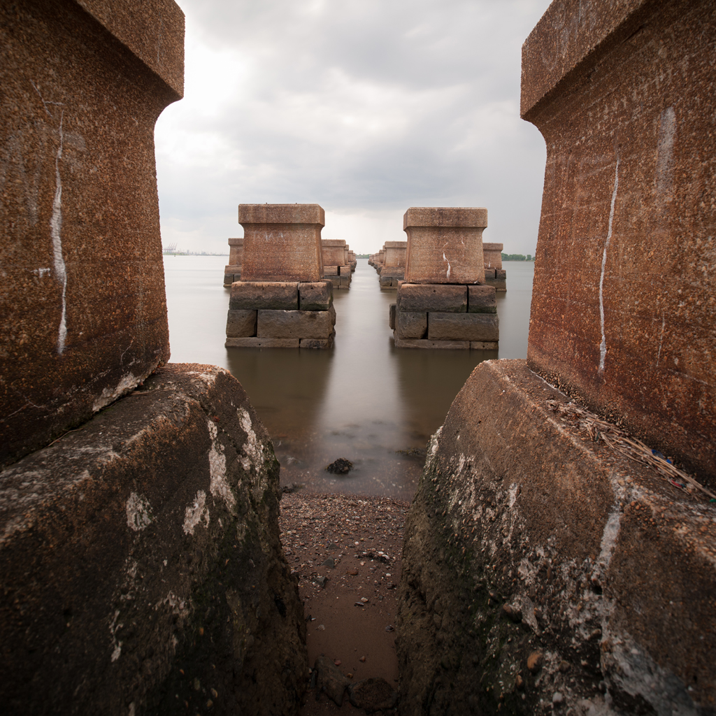
CRRNJ Newark Bay Bridge piers, 2015
Central Railroad of New Jersey Newark Bay Bridge piers, 2015

[ continue to references ]

Marine Parkway Bridge

Marine Parkway Bridge

Crosses: Rockaway Inlet in Jamaica Bay
Connects: Floyd Bennett Field, Brooklyn and the Rockaways, Queens, NY [satellite map]
Carries: 4 vehicular lanes, 1 pedestrian sidewalk
Design: vertical lift bridge
Date opened: July 3, 1937
Postcard view: “Marine Parkway Bridge, Brooklyn, N.Y.”

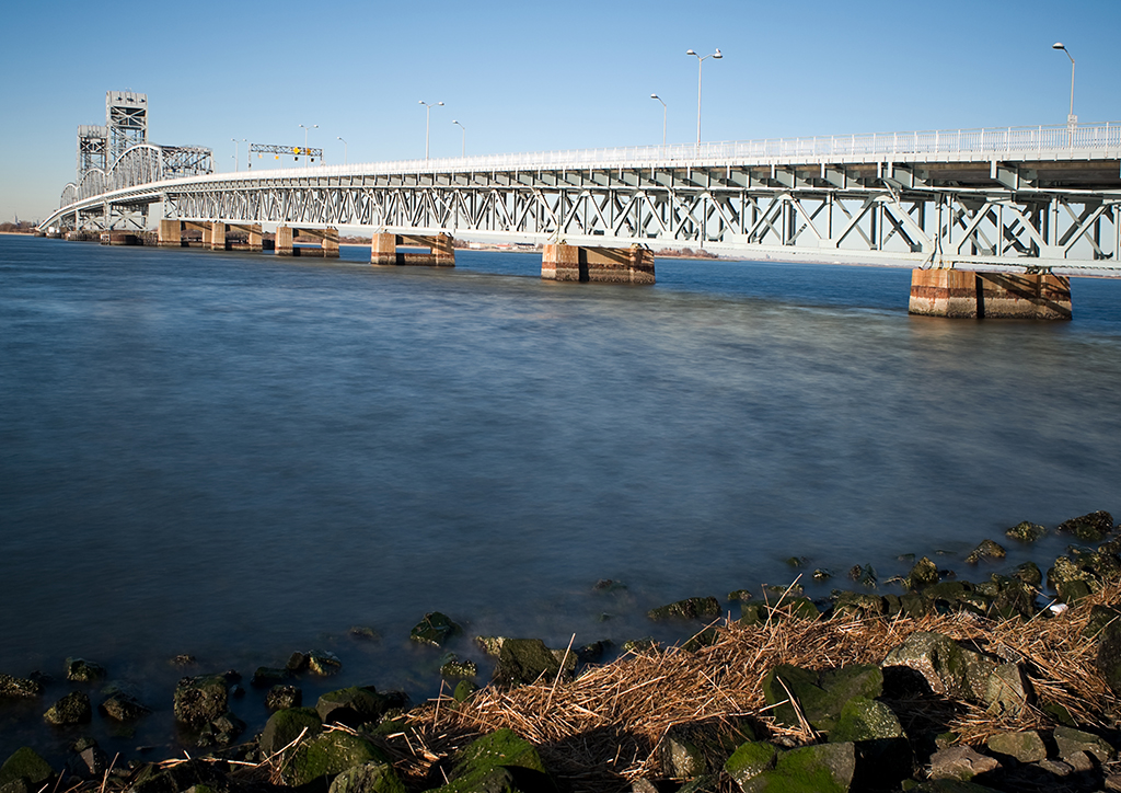
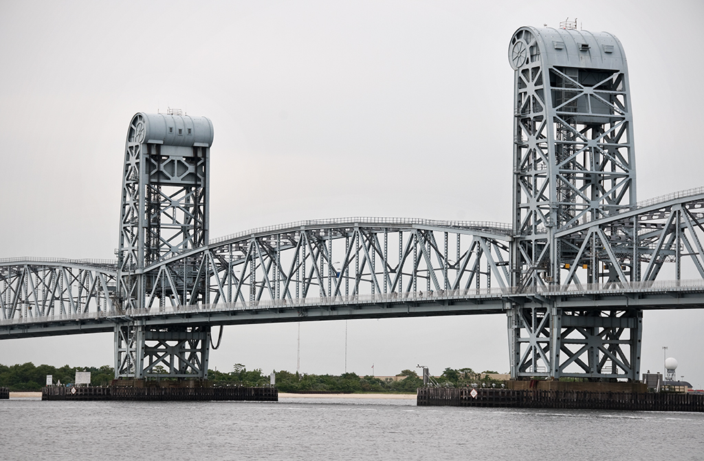
The Marine Parkway Bridge (also known as the Marine Parkway-Gil Hodges Memorial Bridge) is a vertical lift bridge which connects Flatbush Avenue at Floyd Bennett Field in Brooklyn with Jacob Riis Park and Fort Tilden in the Rockways in Queens.

Plans for a New Bridge: Robert Moses & The Marine Parkway Authority

Fiorello LaGuardia was narrowly elected Mayor of New York City in 1933; he would serve three terms from 1934 to 1945. LaGuardia was impressed by the parkways Robert Moses had built in Long Island (and by his ability to raise federal funds to finance them), and he immediately offered him a job in his administration. Moses had plans for parkways and parks in New York City ready to go, and he only agreed to take the job from LaGuardia if he would have control of the parks departments in all five boroughs, which had previously been independent of one another. Moses also wanted control of the parkways; LaGuardia agreed. Moses quickly took over the the Triborough Bridge Authority; that bridge’s construction had begun in 1929 but had stalled and remained incomplete. He also introduced a plan to finance construction of the Marine Parkway Bridge that called for the creation of the Marine Parkway Authority, of which, of course, Moses would be chairman and sole member. He raised money for these and other projects (which would charge tolls when they opened) by issuing bonds; when a project was complete, he would not sell off the bonds but would begin another toll-collecting project, continuing the cycle.

Opposition

Moses issued $6,000,000 in bonds in order to build the Marine Parkway Bridge, and it was expected that within 25 years, through toll collection the bridge would pay for the loan and allow the bridge to be self-sustaining. However, there was plenty of opposition to the bridge proposal. The surrounding communities had been served by ferries and many people did not want to see that change. There were others who felt that Jamaica Bay might one day become a major port and the building of a bridge would destroy that potential. So, more than $18 million was spent by the U.S. War Department to dredge Rockaway Inlet and the bridge was designed to be a lift span, to enable the channel to remain clear for ship traffic. There was also the issue of ice: it was feared that ice would pile up on the bridge piers and either block passage or cause the surrounding areas to flood, sweeping cottages along Rockaway Beach out to sea. The solution was to bring in a forest of 600-foot-tall Douglas fir trees from the west coast to be driven into the sand and act as fenders against the ice around the bridge’s piers.

Marine Parkway Bridge, seen from Floyd Bennett Field

The Barren Island Squatters

Another problem encountered before construction of the bridge could begin was a well-established colony of squatters living on what formerly was known as Barren Island. Barren Island was a roughly three mile long and one mile wide stretch in the southern Brooklyn section of Jamaica Bay. In the late 1800s, the land at either end of the island the island was home to several putrid-smelling industries including fish, fat, and offal rendering plants and another that rendered horse bones into glue, leading to the the body of water on the island’s western shore’s name: Dead Horse Bay. About 120 acres in the center of the island was owned by the city, intended to be used as a dumping ground. However, due to the city’s neglect, the land was taken over by a colony of squatters, who by 1877 numbered around 100. The squatters kept livestock such as goats and pigs, and even set up a liquor saloon on the island. The stench of the rendering plants grew worse and worse, and after years of complaints from Brooklyn residents, the plants were required to dump their refuse at sea. The Brooklyn Daily Eagle described the situation in 1899 as being “improved:”

Nowadays the ancient cheeses, the butchers’ offal, the long-deceased animals, the contents of refuse cans and barrels are not piled along the waterfront… On the contrary, the process is quick and thorough. Deodorizing substances are freely used in the materials that are disgorged from New York’s thousands of kitchens and butcher shops. The sufferings that are reported in various parts of Brooklyn and along the south shore probably result in larger measure than the people realize from the dumping which is still carried on at sea, the scows going out six or eight miles, instead of the required forty, and throwing overboard tons of swill that the incoming tide washes upon the shored of Coney Island, Rockaway and even Long Beach. This vile stuff festers in the sun, sours and breeds maggots and flies by millions. [1]

Despite many attempts over the years to remove the squatters, they stayed put. Barren Island was connected to the Brooklyn mainland with landfill during the construction of Floyd Bennett Field (New York City’s first municipal airport), which opened in 1931. By then the rendering plants were long gone, but the squatters still remained. In 1936, Robert Moses, as Park Commissioner, called for their eviction; at that time there were an estimated 90 squatters (and their livestock) still living on the former island. They were given until April 15, 1936 to vacate, and Alderman Joseph B. Whitty of Brooklyn was granted a promise by Mayor LaGuardia that the houses on the island would be treated as “condemned tenements” [2], so that the squatters would be provided with free moving service as they left the island. In August of the same year, five acres of marijuana plants were discovered on the island, upon which the goats the squatters had kept had been grazing. The squatters, when questioned, denied that there was any other intended use for the plants.

Engineering

Moses the planner had engineers ready to work on the Marine Parkway Bridge. The chief engineer on the project was Rensselaer Polytechnic Institute graduate Emil H. Praeger (who worked on numerous projects for the Parks system and went on to design the Tappan Zee Bridge). The firm of Madigan-Hyland were also involved as engineers. Robinson & Steinman were hired as consultants; Holton D. Robinson was the engineer of the Williamsburg Bridge and David Steinman designed the Henry Hudson Bridge as his thesis while at Columbia University. The title of Engineering Designer was filled by the esteemed Waddell & Hardesty, formed in 1927. Also both Rensselaer graduates, the firm of J.A.L. Waddell and Shortridge Hardesty was known for its movable bridge designs, especially vertical lift spans. The contractors awarded the bids for construction of the bridge were the Frederic Snare Corporation and the American Bridge Company.

Construction & Design

Construction began on June 1, 1936. A method differing from usual lift bridge construction was used, where instead of floating the lift span in at the very end, it was placed partway through, planned to coincide with a particularly high tide. Just after midnight on January 12, 1937, 38 workmen from the American Bridge Company began the operation; tugboats guided the central span along and at 7:45 a.m., while the tide was at its highest, it was placed into position. The partially built towers had a special trestle attached to their foundations from which the towers would be completed.

The bridge is designed of three main 540-foot spans, each allowing for a 500-foot clear channel. There are two 1,061-foot approaches; its total length is 4,022 feet, 6 inches. The 2,000-ton central span could be raised from 50 feet to a total clearance of 150 feet above the high water mark in two minutes. When it was completed it was the longest highway lift bridge in the world (it is still the longest of its type in North America), built of 12,000 tons of steel and 47,000 cubic yards of concrete. The bridge was painted olive green with silver trim. The roadway, instead of being solid, was built of steel plates, similar to subway gratings set in sidewalks throughout the city. It was the first roadway of this type to be used on a bridge on the East Coast. The open grates were also painted green.

One complaint about vertical lift bridges at the time was that their appearance could be ugly; often they were employed by railroads and were decidedly utilitarian in design. In response to this, the towers of the Marine Parkway Bridge were tapered and a pattern designed to hint at the great wheels that lifted the bridge rather than hiding them [3]. Construction was finished less than a year after it began, and the bridge was scheduled to open in July, in time for motorists to enjoy the summer in the new Jacob Riis Park.

Marine Parkway Bridge from Rockaway

Opening Ceremony

The bridge officially opened on July 3, 1937. The ceremony was headed by Mayor LaGuardia who was joined by Park Commissioner Robert Moses and various other city officials. 500 cars full of invited guests waited on the Brooklyn side of the bridge, on the approach built on Barren Island. Guns were fired from Fort Tilden, fireboats sprayed water into the air, and nine Martin planes flew in formation overhead. The center span was lowered for traffic and at 10:30 a.m. a parade of cars began to cross the bridge to Jacob Riis Park, where Moses gave a speech detailing the planning that had led up to the building of the bridge. It was given recognition in the engineering world as well: The National Steel Bridge Alliance awarded it first place in the movable bridge category in 1937.

Renaming & Rehabilitation

The bridge was renamed in 1978 in honor of Gil Hodges, a former Brooklyn Dodgers first baseman, though the name has not taken into common usage [4]. The Marine Parkway Authority was absorbed into the larger Triborough Bridge Authority in 1940 (becoming he Triborough Bridge and Tunnel Authority in 1946). Traffic and toll collection on the Marine Parkway Bridge did not turn out to be enough to pay for its own expenses, but other bridges and tunnels run by the TBTA were profitable enough to carry those that were less so. The TBTA is now under the jurisdiction of the MTA, who began a major rehabilitation project on the bridge in 1998. The steel deck was replaced with concrete and steel, a “Jersey” barrier was added to separate traffic, electrical systems and traffic control were updated, and new signs were put in place. The $120 million project was finished in 2004; the bridge still opens more than 100 times a year.

[ continue to references ]

Passaic River Bridge (1&9)

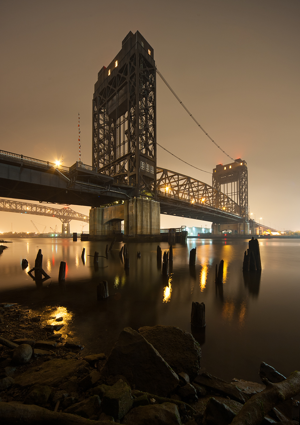
Passaic River Bridge with Pulaski Skyway in background

Crosses: Passaic River
Connects: South Kearny and Newark, NJ [satellite map]
Carries: 4 vehicular lanes, 2 sidewalks
Design: vertical lift
Date opened: January 26, 1941

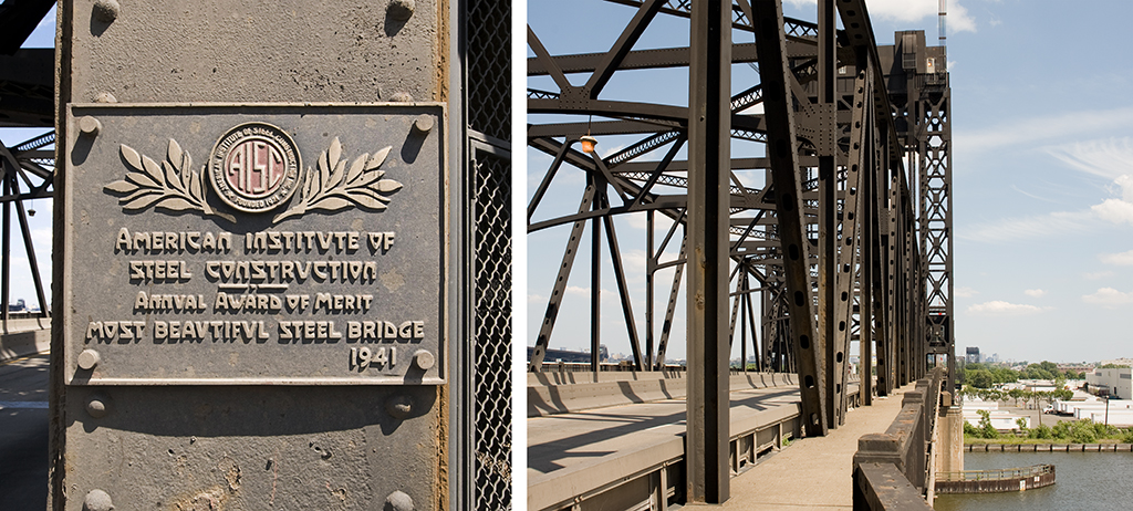
Traveling east along the 1&9 Truck Route from Newark to Jersey City, you may notice a small steel plaque on the Passaic River crossing proclaiming that span to be 1941’s Most Beautiful Steel Bridge. That designation, given by the American Institute of Steel Construction, was awarded the year that bridge opened to traffic.

The bridge replaced a low level swing span that had been in place since 1921. That bridge, with a 10 foot clearance over the river, required an average of 30 openings a day to accommodate marine traffic, causing significant automobile traffic delays. Problems were exacerbated by the opening of the Holland Tunnel in 1927 as the final link between the interstate Lincoln Highway and New York City. Though the opening of the Pulaski Skyway, located just a short distance north of this route, was intended to alleviate these problems, the Skyway was effectively obsolete as soon as it was opened to traffic. The diversion of all truck traffic from the Skyway in 1933 further complicated problems along the route. Construction of a new span commenced in 1938, at a projected cost of two million dollars.

Design

The vertical lift design of the new bridge required the construction of two large steel towers on each side of the navigation channel, connected by a movable deck, which has a span of 332.5 feet. In the closed position, the new bridge provided 40 feet of clearance over the Passaic, reducing the number of daily bridge openings to an estimated 5 per day. Tower drive motors, a fairly new innovation at the time, were able to lift the deck 95 feet above its closed position, allowing for a maximum of 135 feet clearance, a minimum height specified by the War Department for marine crossings. The chief engineer was Morris Goodkind, with the firm of Howard, Needles, Tammen and Bergendoff as consulting engineers. The substructure was fabricated by Senior and Palmer and the superstructure by the American Bridge Company.

Plaque and bridge walkway

Construction

The Passaic River Bridge took three years to complete under the supervision of lead engineer Morris Goodkind and the New Jersey State Highway Commission, with the final cost just barely exceeding the projected estimate by just under $56,000. The bridge was constructed as close to the south side of the old span as logistically possible in order to ease the transfer of the traffic alignment from the old bridge to the new. During the final phase of construction, with everything in place except for the moveable deck, river traffic was halted for 72 hours while the deck could be installed.

In what must have been a very carefully choreographed procedure, the deck was floated into the work location on a barge at high tide and aligned with the rest of the structure. As the tide receded, the deck gradually sank into position on the bridge piers. After the 64 lifting ropes attached to the lift’s counterweights were connected to the deck, the bridge was essentially complete, save for some fine tuning needed to ensure proper bridge operation. It was opened to traffic at 11 PM on Sunday, January 14th, 1941.

[ continue to references ]